
Whenever one reads the name Gwalior, the majestic royal Gwalior Fort rings the first bell. The Gwalior-Gohud belt of northernmost Madhya Pradesh consists of some important Bundelkhandi forts, fortresses and palaces that protected various ruling clans from their enemies.
The earliest mention of Gwalior was in the middle ages as Mahesvarapura, near the Kanyakubja kingdom that existed in the adjacent Ganga valley. Later, during the 8th century, in the era of the Gurjara-Pratiharas, the city was known as Gopadri. During the arrival of the Islamic conquerors, the Gwalior region exchanged into the hands of the Kacchapagatas, a ruling class of Rajputs in central India. Interestingly, the Arab knowledge of the city was such that it was labelled as Gwaliyar in the 11th century AD. And hence, when the Mamluk Sulnatate dominated northern India in the 12th and 13th centuries, the name Gwaliyar stuck by. Consequently, the power passed from the Tomaras (who started a civil war against Ibrahim Lodi in 1518) to the Bundelas, whose internal rivalries the Mughals took advantage of.
The Gwalior Residency had several Princely States aligned to it at the partition. District-wise, it was divided into the following administrative units:
- Sheopur
- Narwar
- Gird Gwalior
- Bhind
- Tonwargarh
- Isagarh
- Khaniadhana
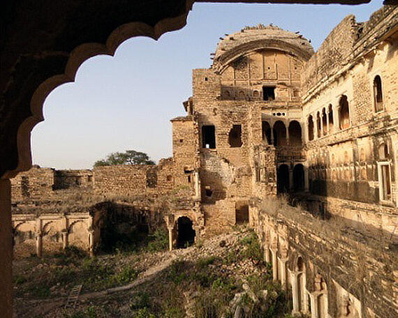
But apart from these administrative divisions, the Gwalior region consisted of numerous forts and ancient ruins. According to 1821 dated map by Aaron Arrowsmith, the following forts and ruins are marked in this region listed below with their images.


No comments:
Post a Comment